The deposits of asbestos are commonly found in both rocks and soil throughout the globe. Historically, this material has been incorporated for more than 4,500 years for a number of purposes by our ancestors. However, mining of asbestos in large scale started only in the 1870’s in Quebec, Canada. It only took about a decade after this commencement before other countries picked the trail and also began the production of asbestos for industrial uses as asbestos rapidly grew to become an ubiquitous phenomenon across many nations of the world such as the USA, Russia, Italy as well as South Africa.
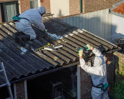
Today, several countries have placed a total ban on the production as well as exportation of asbestos as a result of the harmful fibre it contains. Asbestos has been discovered to be a life threatening material which when disturbed, it releases a harmful fibre that can lead to a number of serious health issues if inhaled over a long period of time. Most recently in 2019, the material was popularly banned in Canada, who for several years has operated the world’s largest mine of asbestos in Quebec.
Despite how harmful the material is, it’s however still being mined in some countries with some of its exporters being Russia, Kazakhstan, China as well as Brazil, with Russia taking the lead, covering for over 53 percent of the world’s total production.
Contrary to many beliefs, asbestos is not a man made material but a group of six types of naturally occurring fibrous minerals that are commonly found in rock and soil which are collectively known as asbestos. These minerals are primarily composed of both silicon and oxygen but also includes other minor elements.